This post will focus on the basic installation and implementation of QGIS Desktop software on both Windows and Linux based systems. Installing QGIS: Windows Follow the steps below to install QGIS on Windows systems. This includes Windows 7, 8, 8.1, and 10. Navigate to https://qgis.org/en/site/forusers/download.html in your browser to find the downloads page for various […]
Creating PostgreSQL Database for QGIS
QGIS has native support for geospatial databases using PostgreSQL as a back end. PostgreSQL can be fully geospatially enabled using the PostGIS extensions to allow for direct geospatial manipulation within the database itself. Installing PostgreSQL (Windows) As of this writing, the latest supported version of PostgreSQL for QGIS 3.4 is PostgreSQL 10.x. An interactive installer […]
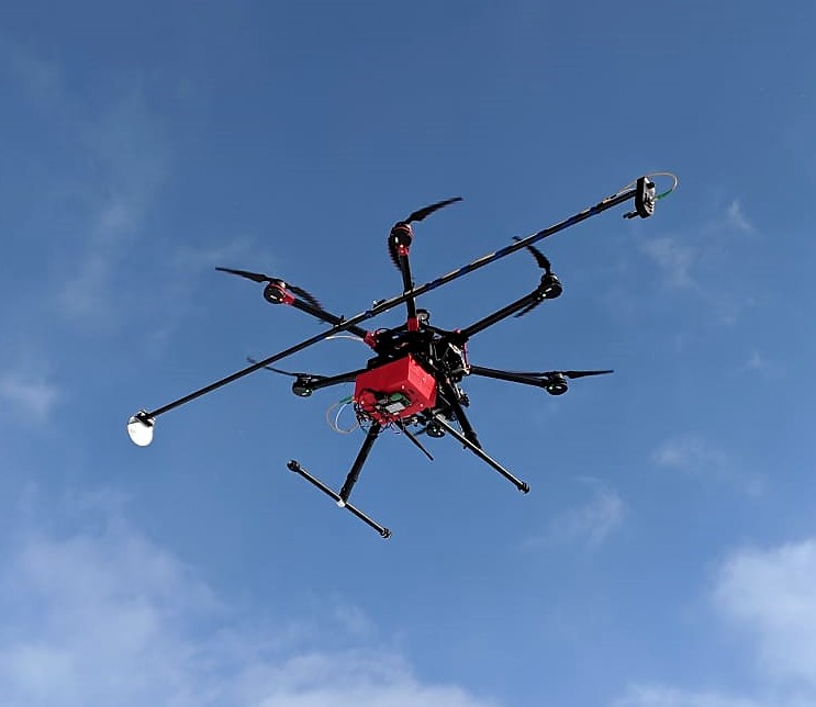
UAV methane detection now available
We are excited to announce the acquisition of a brand-new state-of-the-art UAV mounted methane detection system. Beginning early March 2019 Silver Spring Energy Consulting Ltd. will be using a UAV mounted system to detect and map methane in the atmosphere. This system is based on Boreal Laser’s tested and industry proven laser methane detection system that has been used on manned aircraft for several years to detect pipeline leaks, and map methane emissions from agricultural and industry facilities.
For more information on how we can help you with your gas detection needs, please visit our contact page.