Silver Spring Energy Consulting Ltd. can generate a full range of cartographic products for electronic and printed distribution. We specialize in thematic maps showing statistical distributions, land use classification, contaminant plume propagation and flood plain analysis.
Our services include:
- Linking of statistical or experimental data to geographic locations.
- Generation of thematic maps to communicate a message.
- Ongoing map creation and maintenance to help visualize changing data sets.
- Flood plain analysis.
- Cost-path analysis.
- Geological structure.
- Groundwater contaminant plumes.
- Viewshed analysis to predict the impact a new structure will have on the horizon.
- Slope analysis.
- Solar panel placement optimization based on annual average incident light calculations.
- Web maps and interactive cartographic applications for your golf course, theme park, campus or resort.
Thematic cartography
Maps can be a powerful means to communicate and visualize data as it relates to geography. While programs like Excel can provide excellent numerical and graphical analysis tools, sometimes it is advantageous to map out the data as it relates to the physical world. This is particularly useful when visualizing population distributions, environmental trends, geological formations and any number of other types of data.
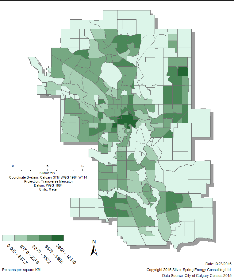
City of Calgary Community Population Density in 2015
People love looking at maps, they provide an intuitive way to communicate information to the intended audience. However a bad map can reduce the effectiveness of that message or in some cases cause a total loss of the intended message. We believe that good cartography is as much an art as it is a scientific tool and we strive to produce clear and effective maps to help you communicate exactly what you want to your audience.
Web maps and web applications
With the advent of the internet and mobile devices, web maps and applications are becoming increasingly prevalent in our day-to-day lives. The web brings a whole host of new possibilities to communicate ever more information via maps. Web maps can not only display static information but may be fully interactive, with links to images, graphs or other information a mere click away. This is also the most rapidly changing part of our industry and we strive to stay abreast of new techniques and technologies available to help our clients produce modern and informative web maps and applications.
We are able to generate custom web mapping products using both ESRI’s ArcGIS Online or Google’s mapping services. Both are excellent products that each lend themselves to different applications. When you come to us with your project requirements we will identify the best technology for your purposes.