Geoportal
To access Geoportal click on the link below:
geoportal.silverspringenergy.com
What is the geoportal?
Silver Spring Energy Consulting Ltd. has developed a full geological reporting platform for our clients and third party consulting firms. It is a database driven platform for storing, sharing and generating standardized reports for wells as they are drilled. Version 2.0 of Geoportal was released on February 22 2021.
Version 2.0 updates
Originally Geoportal was envisioned as a place for our wellsite geologists and mudloggers to enter data and share with our clients. Version 1 was in testing from the end of 2019 up until the release of Geoportal V2 in February 2021. In that time we took the feedback from our contractors, clients and other interested parties and made significant improvements to the portal’s design and functionality.
The key takeaways with Geoportal V2 are that we can now represent more than just wellsite geologists to our clients, and the entire portal has been streamlined for enhanced usability and improved functionality. It can also now be used to track safety and regulatory compliance of all our subcontractors.
Performance enhancements
Significant effort was put into speeding up the portal to make it more useful for field staff. Overall we were able to reduce processing time by 91% when compared to version 1 and reduce the amount of data that the user’s computer needs to download by 30%. To put it in perspective, when loading a website like Facebook, the user needs to download several megabytes of data. With Geoportal V2, the user needs to download less than half a megabyte of data per page. This is extremely important when dealing with remote sites that may have spotty internet connections.
UI redesign
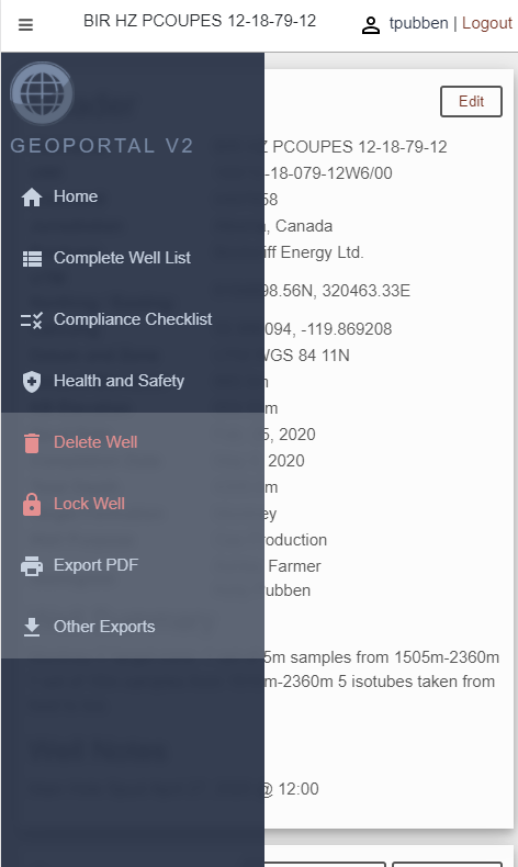
Version 1 of the portal was admittedly a beta product. The UI was designed around a series of menu bars and a two-stage system where a user toggled between “edit mode” and “view mode”. This was done to ensure complete separation so that users without permissions to edit wells could not accidentally or maliciously make changes to a well report. The redesign has done away with that and keeps every aspect of the reporting system no more than one click away.
We have also moved to dashboard style design that uses cards to separate well report sections. We have moved to a mobile-first design that ensures the well reports look great and function perfectly on mobile devices while retaining exceptional functionality on desktop web browsers.
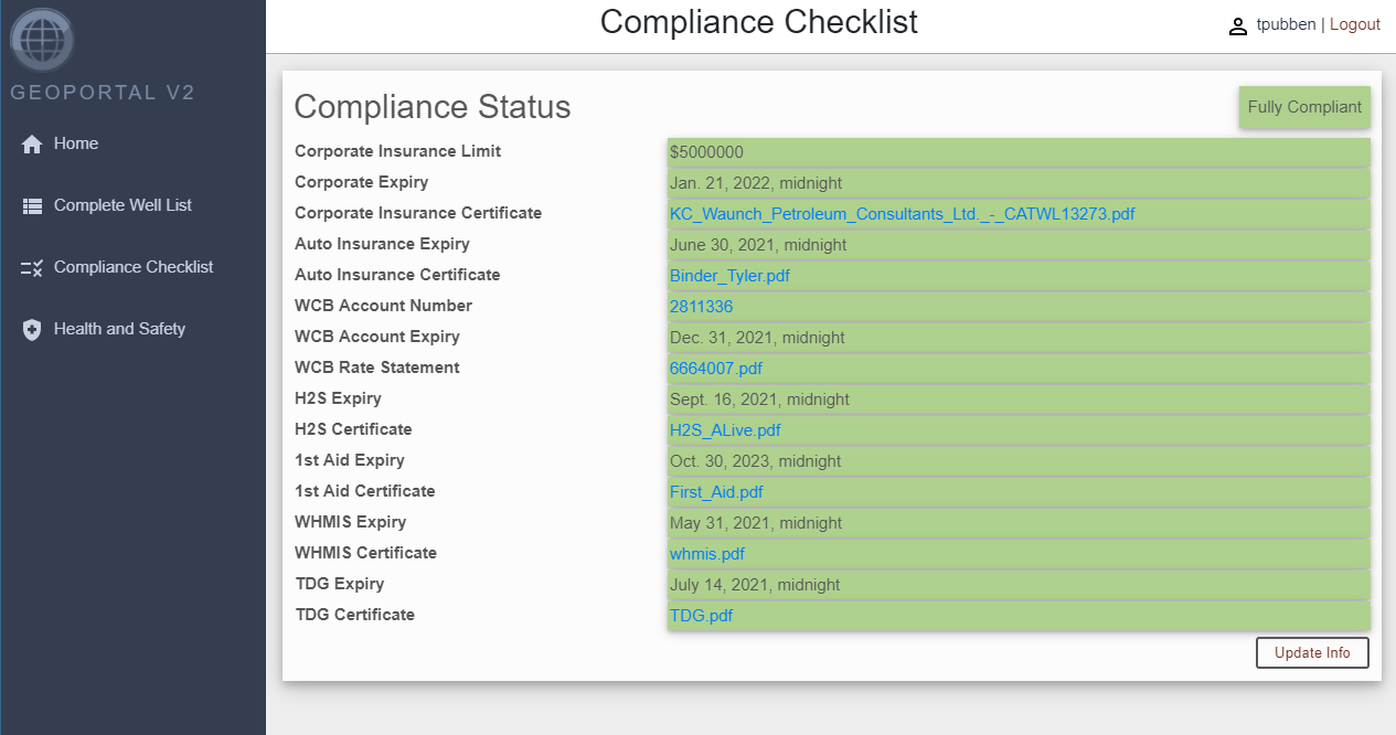
Safety reporting and tracking
Geoportal V2 adds functionality to track subcontractor safety certificates and other compliance items to ensure our contractors are fully qualified to be in the field. This also allows us to operate as an agency through which fully independent contractors can work and use our COR, APEGA registration and memberships with ISNetworld, ComplyWorks and other industry requirements.
We also provide online safety reporting forms for journey management, hazard identification, incident reporting, incident investigation/results and site orientation tracking. This allows us to collect and analyze the necessary safety statistics to maintain our COR as well as satisfy the needs of our clients.
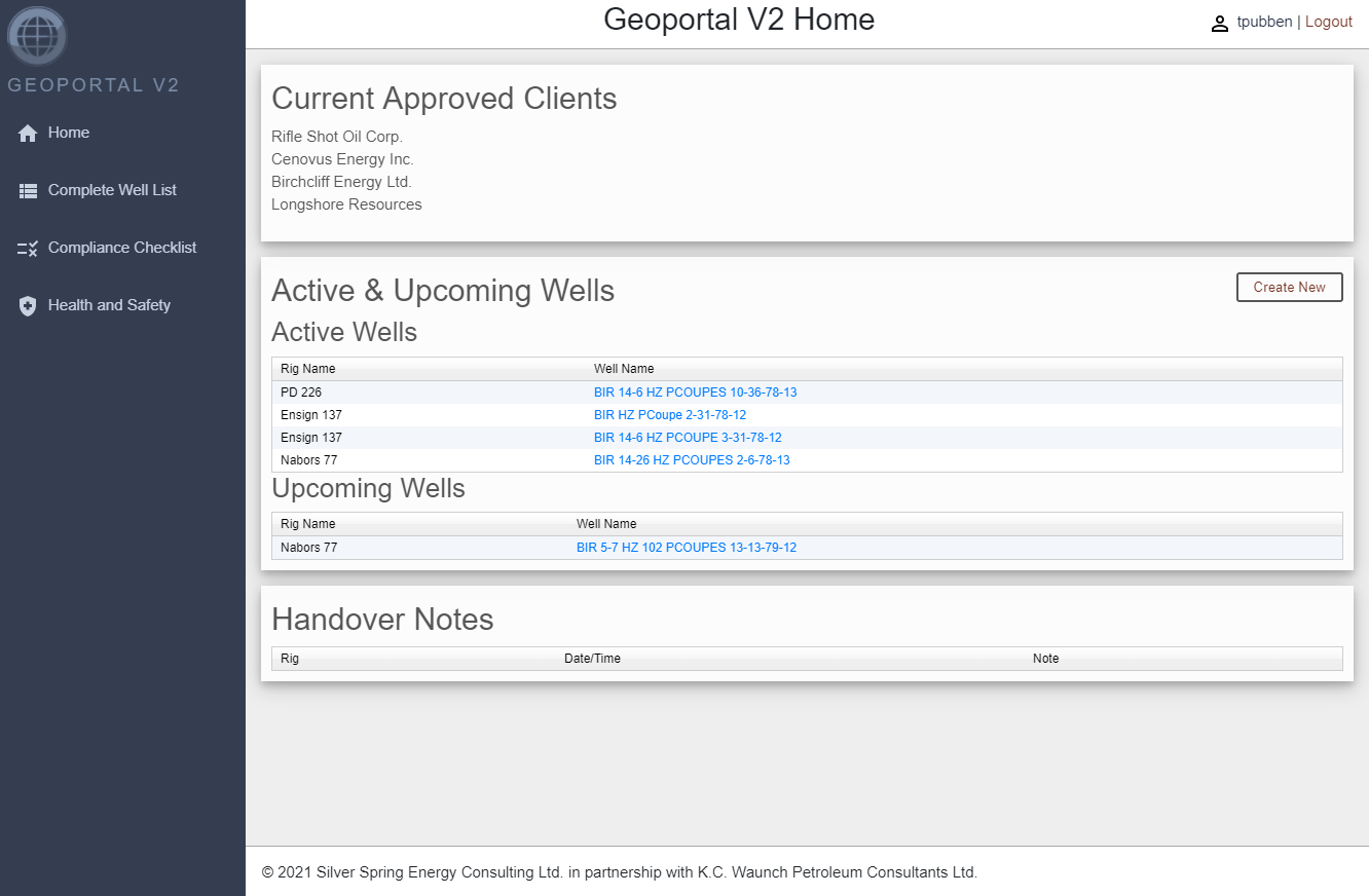
Track upcoming and current wells
Geoportal lets you and your clients see all of the actively drilling and upcoming wells at a quick glance. Make morning meetings more dynamic by quickly checking in on the status of multiple rigs directly from the web browser on your computer, phone or tablet.
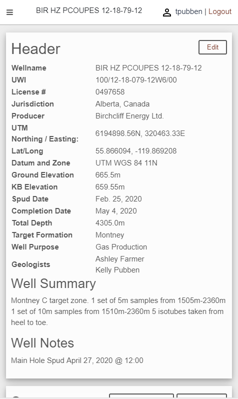
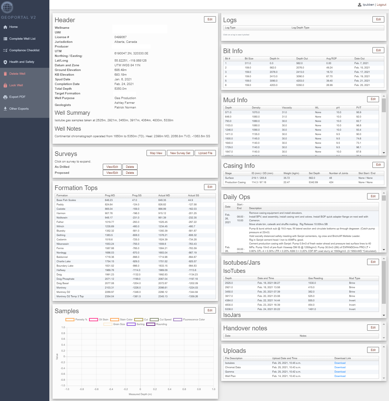
Geoportal allows for the storage and quick access of the following:
- Well license and well location information
- Well surveys
- Slides
- Down-hole and open-hole logs
- Daily operations
- Mud data
- Bit information
- Casing information
- Sample information
- Gas and mud fluid samples
- Uploads like striplogs, offset cross sections etc.
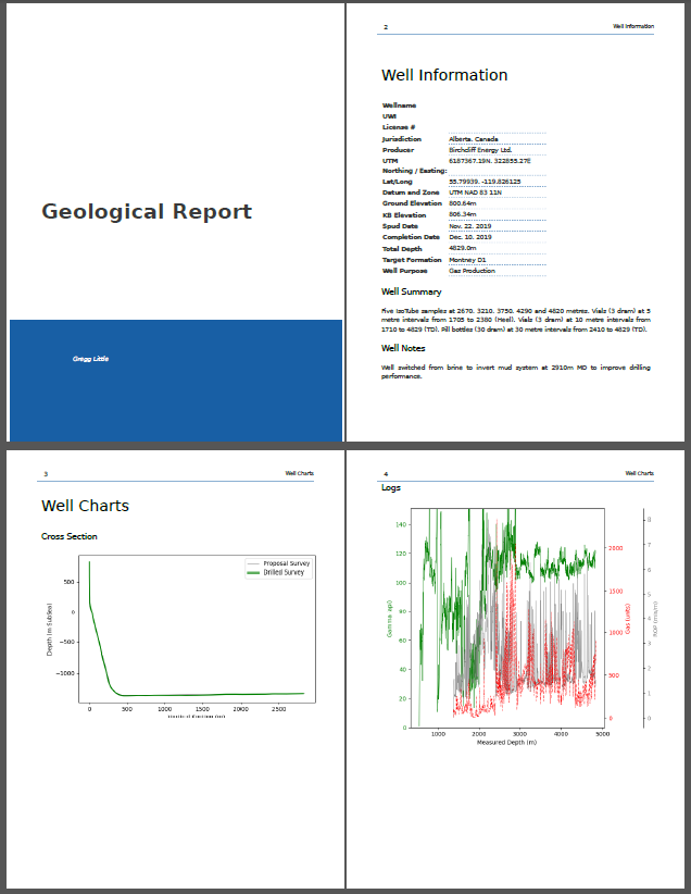
Upon well completion data can be exported as a PDF or a wide range of other file types for import into our clients databases.
Sharing information between all necessary parties
Client companies can specify who does and does not have access to their well data. This allows wellsite geologists, wellsite leaders, directional drillers, office geologists and geosteering teams to work together and share data on the fly. This ensures all stakeholders and contractors have access to the most up-to-date information to help make timely and informed operational decisions.
Handover notes are time-stamped and available for all to read, making it easy to keep track of what information was and was not passed along at shift change.
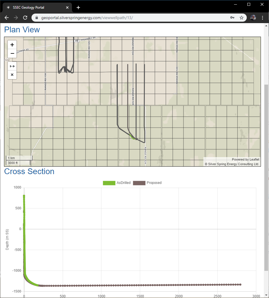
Visualizing data and wellpaths
Our visualization tools allow operations and wellsite staff to keep track of a well’s progress and it’s geographic location relative to offsets. They also allow field staff to measure distances to offsets and possible hard boundaries.
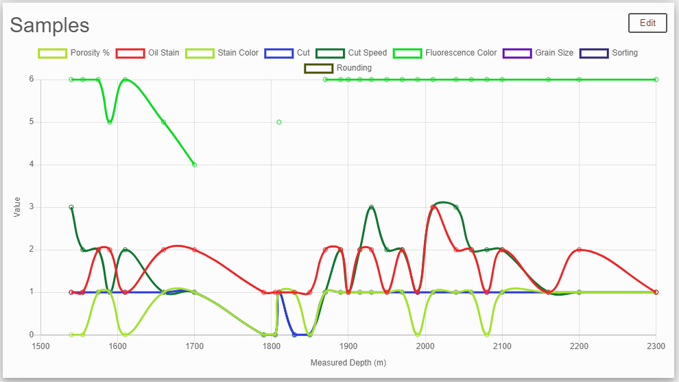
Our sample charting makes it easy to quickly filter sample descriptions to see sample quality trends or variations in key reservoir qualities such as porosity and hydrocarbon saturation.
Data export
After a well is completed, it is easy and quick to export a beautiful, standardized report.
More information
If you’re interested in using our system please contact us.