QGIS natively supports adding XYZ tiles to projects as background layers, from multiple sources. Here is a basic walkthrough as to how to connect XYZ tile services to your QGIS project.
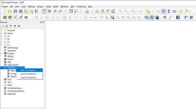
- Open a QGIS Project and navigate to the ‘XYZ Tiles’ option in the Browser panel. Right click and select ‘New connection…’
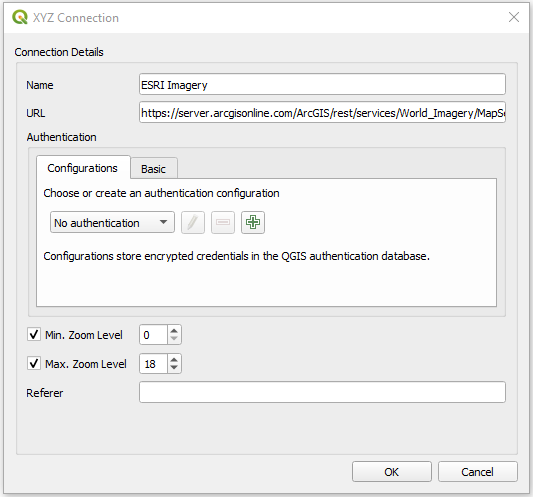
- In the XYZ Connection window, provide a name appropriate for the service you are connecting to, and enter the URL of the tile service. Finding these URLs can be challenging, however there are repositories for other plugins that have these. For this example, a connection to the ESRI satellite imagery service will be established using the URL https://server.arcgisonline.com/ArcGIS/rest/services/World_Imagery/MapServer/tile/{z}/{y}/{x}. As it is an open service, no authentication is required so these settings should be left as default.
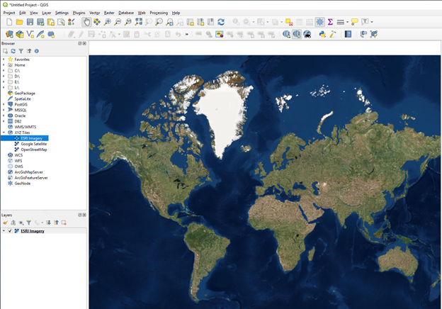
- Select Ok to establish the connection, and a new option should be added under XYZ Tiles in the Browser Panel, under the name given in the previous step. This can now be added to the project as a data layer.